
Latest Posts by subtropic - Page 2
Posted on my tiktok: Weather Studios!
Tornadoes of the 1990's (part 1)


A massive hurricane as seen from the ISS


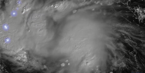

Hurricane —Lisa and Martin l CIRA
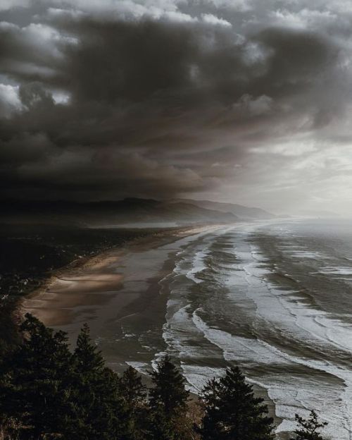
Nokomis Beach, Casey Key, Florida, as Hurricane Idalia approached landfall.

Satellite view of the eye of Hurricane Dorian approaching the Bahamas, 2019.


“ Why do you like thunderstorms?”
“ Because it shows that even nature needs to scream sometimes.”
~E.D.
Monster supercell in the Texas Panhandle.


Greg Johnson
Argentina


xx
Bonita Gabrielle


Ways NASA Studies the Ocean
We live on a water planet. The ocean covers a huge part of the Earth's surface – earning it the name Blue Marble.
The ocean is one of Earth’s largest ecosystems and helps moderate Earth’s climate. NASA scientists spend a lot of time studying the ocean and how it is changing as Earth’s climate changes.
In the last few years, NASA has launched an array of missions dedicated to studying this precious part of our planet, with more to come. For World Oceans Month, which starts in June, here are new ways NASA studies the ocean.
1. Seeing the colors of the ocean 🎨
A new NASA mission called PACE will see Earth’s oceans in more color than ever before. The color of the ocean is determined by the interaction of sunlight with substances or particles present in seawater.
Scheduled to launch in 2024, PACE will help scientists assess ocean health by measuring the distribution of phytoplankton, tiny plants and algae that sustain the marine food web. PACE will also continue measuring key atmospheric variables associated with air quality and Earth's climate.

2. Surveying surface water around the globe 💧
The SWOT satellite, launched in late 2022, is studying Earth’s freshwater – from oceans and coasts to rivers, lakes and more – to create the first global survey of Earth’s surface water.
SWOT is able to measure the elevation of water, observing how major bodies of water are changing and detecting ocean features. The data SWOT collects will help scientists assess water resources, track regional sea level changes, monitor changing coastlines, and observe small ocean currents and eddies.

3. Setting sail to understand interactions between the ocean and atmosphere 🚢
With research aircraft, a research ship, and autonomous ocean instruments like gliders, NASA’s S-MODE mission is setting sail to study Earth’s oceans up close. Their goal? To understand ocean whirlpools, eddies and currents.
These swirling ocean features drive the give-and-take of nutrients and energy between the ocean and atmosphere and, ultimately, help shape Earth’s climate.

4. Building ocean satellites the size of a shoebox 📦
NASA’s HawkEye instrument collects ocean color data and captures gorgeous images of Earth from its orbit just over 355 miles (575 kilometers) above Earth’s surface. It’s also aboard a tiny satellite measuring just 10cm x 10 cm x 30 cm – about the size of a shoebox!

5. Designing new missions to study Earth’s oceans! 🌊
NASA is currently designing a new space-based instrument called GLIMR that will help scientists observe and monitor oceans throughout the Gulf of Mexico, the southeastern U.S. coastline and the Amazon River plume that stretches to the Atlantic Ocean. GLIMR will also provide important information about oil spills, harmful algae blooms, water quality and more to local agencies.

6. Taking the ocean to new heights ⬆️
The U.S.-European Sentinel-6 Michael Freilich satellite is helping researchers measure the height of the ocean - a key component in understanding how Earth’s climate is changing.
This mission, which launched in 2020, has a serious job to do. It’s not only helping meteorologists improve their weather forecasts, but it’s helping researchers understand how climate change is changing Earth’s coastlines in real time.
Make sure to follow us on Tumblr for your regular dose of space!
Climate change causes Polar Vortex to venture south

this.
this right here is why it's called "climate change." Arctic warming = deep freeze in the temperate regions, because Arctic ice melting warms the ocean up there, messing with the Jet Stream and driving the cold air mass southward
stories that go into depth:
"What’s Behind the ‘Arctic Blast’ Plunging into the U.S.?" - Scientific American
"How Frigid Polar Vortex Blasts are Connected to Global Warming" - CitizenTruth.org
not only was 2023 officially the hottest year on record by a long shot (1.5°C above preindustrial levels), but this winter is on track to be one of the coldest
Interesting Times we live in, folks

Last Chance, CO tornado of ‘93

Nebraska, 2019

“Borealis”
Day 25 - Dangerous
The ol’ North Wind starts to howl.
this is a sideblog
@ghwosty is the main
@blackeneddays is my mostly Pearl Jam & Soundgarden & other adjacent bands sideblog


Charlestown, Indiana- July 29, 1943

Clinton Johnson, Tornado in North Dakota, Library of Congress, 1895
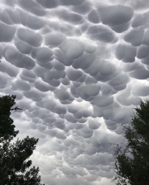
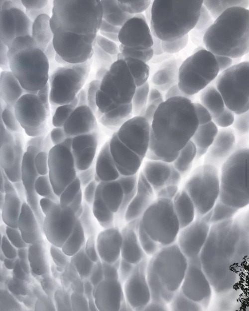
Mammatus Clouds
mammatocumulus, meaning "mammary cloud") is a cellular pattern of pouches hanging underneath the base of a cloud, typically a cumulonimbus raincloud, although they may be attached to other classes of parent clouds. The name mammatus is derived from the Latin mamma (meaning "udder" or "breast").

The EF5 Tracy, Minnesota tornado photographed on June 13th, 1968.


Alfalfa, Oklahoma 1981