Dive into your creative stream
Glacier - Blog Posts


An unexpected crossover with my favorite girls and their snow-white companions ♡
Probé algo nuevo (sufrí)


(Click/Tap for better quality)
A little pose practice in the middle of the night, because sleep is for normal people. And here is Cole and Zane.
Our little robo boy is having mental breakdown on the middle of the night, but luckily he has his boyfriend who will always be there for him😭🖤🤍
I'm kinda skimping for zangst, and it's all because of the @spinchip arts.
It's my fourth serious art, hopefully I'm improving😁


I just love @catjago-official au! Especially glacier in this au!💙🖤 They're just so fricking adorable and sweet!❤️ My boys😭💕💕💞💞
I worked really hard on this one☺️, hopefully you'll like them
Some guy: Did it hurt?
Zane: Wha-
Guy: Did it hurt when you fell from heaven, angel?
Cole, hugging Zane from behind: No, no it didn't. I was there to catch him
Me, going into glaciershipping
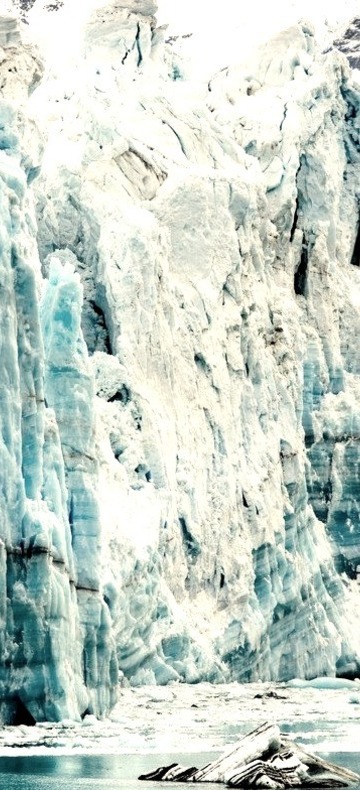
The blue glow of this glacier cave in Iceland
Zane: Cole, what are you doing?
Cole, gently cupping Zane's face: Hold on, there is something on your face...
Cole, kissing Zane: Oh, that was me
Imagine #2:
I was thinking about pirate!au for ninjago, and...
Imagine –
we have 2 the most dangerous pirate ships in the seven seas, called "Phoenix" and "Raiju". And there is two captans, well you can know them. It's obviously Kai and Jay, and they are rivals. Well, you know, – from "hate" to "love" scenario ;).
And of course we have Zane and Cole here. Zane is Jay's right hand man and Cole is Kai's right hand man. And they are basically baby-sitting this two "cool" captain-dorks.
And look, in some kind of way, Zane and Cole get trapped in somewhere together. And they where like "oh, this guy again. I think I need to hate him?? I will just sit here in silence" and after a couple of hours(days, maybe??) of sitting there they will find a lot in common. Like baby-sitting this two idiots and getting their asses out of somewhere, and they will be like "hmm, I kinda like this guy, even if I have to hate him". And after this they would meet much more often than it should be🤔. And after this "accidents" they would be meeting in the purposes, for "just to hang out with someone who can understand me". And then it will grow into something more intimate. Running somewhere together, cuddles, making up more and more things just to see each other often. And first kiss of course. Well, everything is like it should be.
And there goes our "rivals", that "hate" each other. They just being two sassy bastards that are having nice time mocking of each other. But deep inside, they have feelings for each other that they can't understand. And they becaming more and more furious about it. Like "That sh*t hurts! What the hell is this?! Why I'm so flustered around this idiot!? F*ck it!". And sometimes they will just sit alone, and secretly thinking about each other, and they will be sad because of...something? And they will hate each other even more because of this mixed feelings. And then there would be some "moment", when thy will learn about love between their right hand men, at would be like "you betrayed me!" and will have more hate for the other. And after all of this, this two captain-dorks will find out that they actually in love with each other(not without some help from their friends, a lot of help actually. They're just emotional llove-stuck idiots) and would be like "oh". And then goes kissing, cuddling, -bitting-, hugging, crying their souls out for each other at night, and a lot of other cute things💕
Just a lot of angst and fluff and smut and other things!♥️
What do you think?
@rinas-ninjas @kara-is-so-ninja @nightlybirdie
I was thinking about my glacier au recently, and who will be Gaston? Like, I can't imagine anyone... Well maybe Morro?
Little help here?? Who do you think should be this little annoying person ?
Some girls to Zane: hey cutie, are you here on your own? Come with us, and we will have some fun~
Zane, confused and a little scared: s-sorry, I can't-... I'm eh-...
Cole, pushing them aside, angrily hugging Zane: move b*tches, he's mine
Zane's giggling at the background

Am, yeah. Here's part of the art for Beauty and the Beast au I thought about recently.
(Psst, I totally messed up with his left eye, so have a snowflake instead... a lot of snowflakes)
(Psst#2, click/tap for better quality)
Imagine:
Beauty and the beast, but it's glacier...
I need it, I'm drawing it right now
Zane, to random girl on the street: You have a cute smile
Guy next to her, annoyed: She has a boyfriend, you pink-freak
Zane: Oh, me too! But, there are three of them! And actually, they are standing right behind you)
M-ma heart...
Season 11 angst, ANY pairing you want!!!
This is great for the mood I’m in, so…
Cole’s eyes were burning. They seemed to be burning a lot lately. Maybe he was just…too warm. Too used to Zane’s chill. He drew in a shaky breath as another wave washed over him.
Читать дальше

I'm finally did it! I finally did my own au, and here's Zane from it. He is a polar wolf.
That's au where all ninja have "strange period", when they became, like part-animal's, with cute ears and fluffy tails uwu)

His fur is white, but there is a silvery shade on it. On the tips of the ears and tail there is a little blue overflow.
By the way his ears are put everyone understands what his mood(Oh yes, rhymes😎)

And his tail gives him a lot.
For example: when he is frightened, he presses his tail to himself and quietly begins to whine (yes, he may whine like a puppy which he is. Also he can growl and show his teeth when he is angry)
But most of the time he just happily waiving his tale from left to right to say that he is happy to see you.


He is a good boi, who loves being scratched by the ear.

He will always melt under the touch, and he is absolutely and undoubtedly lubit to lie curled up next to someone(probably other team mates)
Next is gonna be Cole, I think...
that's so endearing wth
Zane gets into abstract painting at his therapists suggestion because it helps him visualize his feelings and express them, and he ends up setting up a little studio to center all his art supplies. Cole, partly on his therapists suggestion as well, and his own inclination to earth and art based hobbies, takes up pottery and working with clay. He and Zane share their space and end up making a lot of things together! Cole works up a vase and Zane paints it, that's the system. Their very first collaborative piece is proudly displayed front and center in their living room... despite its lumps and messy paint, they wouldn't replace it for the world
Earth’s Land Ice by the Numbers
“At a glacial pace” used to mean moving so slowly the movement is almost imperceptible. Lately though, glaciers are moving faster. Ice on land is melting and flowing, sending water to the oceans, where it raises sea levels.

In 2018, we launched the Ice, Cloud and Land Elevation Satellite-2 (ICESat-2) to continue a global record of ice elevation. Now, the results are in. Using millions of measurements from a laser in space and quite a bit of math, researchers have confirmed that Earth is rapidly losing ice.
16 Years

ICESat-2 was a follow-up mission to the original ICESat, which launched in 2003 and took measurements until 2009. Comparing the two records tells us how much ice sheets have lost over 16 years.

½ Inch
During those 16 years, melting ice from Antarctica and Greenland was responsible for just over a half-inch of sea level rise. When ice on land melts, it eventually finds its way to the ocean. The rapid melt at the poles is no exception.

400,000 Olympic Swimming Pools
One gigaton of ice holds enough water to fill 400,000 Olympic swimming pools. It’s also enough ice to cover Central Park in New York in more than 1,000 feet of ice.

200 Gigatons
Between 2003 and 2019, Greenland lost 200 gigatons of ice per year. That’s 80 million Olympic swimming pools reaching the ocean every year, just from Greenland alone.

118 Gigatons
During the same time period, Antarctica lost 118 gigatons of ice per year. That’s another 47 million Olympic swimming pools every year. While there has been some elevation gain in the continent’s center from increased snowfall, it’s nowhere near enough to make up for how much ice is lost to the sea from coastal glaciers.

10,000 Pulses
ICESat-2 sends out 10,000 pulses of laser light a second down to Earth’s surface and times how long it takes them to return to the satellite, down to a billionth of a second. That’s how we get such precise measurements of height and changing elevation.

These numbers confirm what scientists have been finding in most previous studies and continue a long record of data showing how Earth’s polar ice is melting. ICESat-2 is a key tool in our toolbox to track how our planet is changing.
Make sure to follow us on Tumblr for your regular dose of space: http://nasa.tumblr.com.
Greenland Refrozen
It won’t be until summertime that a significant amount of melt shows up across the Greenland Ice Sheet. For now, most indications of meltwater ponds and lakes are leftovers from past seasons that have since refrozen.

These photographs were snapped during research flights for NASA’s Operation IceBridge—now in its final year after a decade of airborne missions to map polar ice.

This second image was acquired on April 18, 2019, with the Continuous Airborne Mapping by Optical Translator (CAMBOT) system. The system takes downward-looking images throughout a flight, which can later be used by scientists to interpret other data. This image shows part of a large, frozen lake on Storstrømmen Glacier. This lake also thaws in summertime, which is why it shows up as blue ice.
Lakes atop a glacier, or “supraglacial lakes,” are somewhat stable in terms of their location, according to Joe MacGregor, NASA project scientist for Operation IceBridge. The lake on Storstrømmen is visible in satellite data at least as far back as May 2012. On occasion, water in lakes like this can drain away through a vertical shaft known as a “moulin.” Scientists initially wondered if the dark circular area on the right side of this image could be a moulin, but closer inspection suggested it is just a deeper part of the lake.
See more photos of the frozen lakes in Greenland: https://earthobservatory.nasa.gov/images/144965/greenland-refrozen
Make sure to follow us on Tumblr for your regular dose of space: http://nasa.tumblr.com.
Earth: Our Oasis in Space

Earth: It’s our oasis in space, the one place we know that harbors life. That makes it a weird place -- so far, we haven’t found life anywhere else in the solar system...or beyond. We study our home planet and its delicate balance of water, atmosphere and comfortable temperatures from space, the air, the ocean and the ground.

To celebrate our home, we want to see what you love about our planet. Share a picture, or several, of Earth with #PictureEarth on social media. In return, we’ll share some of our best views of our home, like this one taken from a million miles away by the Earth Polychromatic Imaging Camera (yes, it’s EPIC).

From a DC-8 research plane flying just 1500 feet above Antarctic sea ice, we saw a massive iceberg newly calved off Pine Island Glacier. This is one in a series of large icebergs Pine Island has lost in the last few years – the glacier is one of the fastest melting in Antarctica.

It’s not just planes. We also saw the giant iceberg, known as B-46, from space. Landsat 8 tracked B-46’s progress after it broke off from Pine Island Glacier and began the journey northward, where it began to break apart and melt into the ocean.

Speaking of change, we’ve been launching Earth-observing satellites since 1958. In that time, we’ve seen some major changes. Cutting through soft, sandy soil on its journey to the Bay of Bengal, the Padma River in Bangladesh dances across the landscape in this time-lapse of 30 years’ worth of Landsat images.

Our space-based view of Earth helps us track other natural activities, too. With both a daytime and nighttime view, the Aqua satellite and the Suomi NPP satellite helped us see where wildfires were burning in California, while also tracking burn scars and smoke plumes..

Astronauts have an out-of-this-world view of Earth, literally. A camera mounted on the International Space Station captured this image of Hurricane Florence after it intensified to Category 4.

It’s not just missions studying Earth that capture views of our home planet. Parker Solar Probe turned back and looked at our home planet while en route to the Sun. Earth is the bright, round object.
Want to learn more about our home planet? Check out our third episode of NASA Science Live where we talked about Earth and what makes it so weird.
Make sure to follow us on Tumblr for your regular dose of space: http://nasa.tumblr.com

A Surprising Surge at Vavilov Ice Cap
After moving quite slowly for decades, the outlet glacier of Vavilov Ice Cap began sliding dozens of times faster than is typical. The ice moved fast enough for the fan-shaped edge of the glacier to protrude from an ice cap on October Revolution Island and spread widely across the Kara Sea. The Landsat images above were acquired on July 1, 2013, June 18, 2015, and June 24, 2018, respectively.
“The fact that an apparently stable, cold-based glacier suddenly went from moving 20 meters per year to 20 meters per day was extremely unusual, perhaps unprecedented,” said University of Colorado Boulder glaciologist Michael Willis. “The numbers here are simply nuts. Before this happened, as far as I knew, cold-based glaciers simply didn’t do that...couldn’t do that.”
Willis and his colleagues are still piecing together what triggered such a dramatic surge. They suspect that marine sediments immediately offshore are unusually slippery, perhaps containing clay. Also, water must have somehow found its way under the land-based part of the glacier, reducing friction and priming the ice to slide.
Full story here: go.nasa.gov/2Z931lc
Make sure to follow us on Tumblr for your regular dose of space: http://nasa.tumblr.com
10 Ground-breaking Earth Satellite Images from 2018
In 2018, our satellites captured beautiful imagery from throughout the solar system and beyond. However, some of our favorite visualizations are of this very planet. While this list is by no means exhaustive, it does capture some Earth satellite images from this year that are both visually striking as well as scientifically informative. This list also represents a broad variety of Earth’s features, as well as satellite instrumentation. Take a journey with our eyes in the sky!
10. Hurricane Florence

Before making landfall, Hurricane Florence churned in the Atlantic for a full two weeks — making it among the longest-lived cyclones of the 2018 season. When it finally did hit land on Sep. 14, the storm devastated the southeastern U.S. coast with intense winds, torrential rains and severe flooding.
This natural-color image was acquired by MODIS on the Terra Satellite on Sep. 12, 2018.
Images like this, as well as other satellite information, were used to anticipate the impact of the storm. Our Disasters Program created flood proxy maps that were shared with the Federal Emergency Management Agency (FEMA) and the National Guard to estimate how many and which communities would be most affected by the storm, in order to help prepare recovery efforts ahead of time.
9. Australia’s Lake Eyre Basin

The Lake Eyre Basin covers one-sixth of Australia and is one of the world’s largest internally draining river systems. However, the rivers supported by this system are ephemeral, meaning that they only run for short periods of time following unpredictable rain — the rest of the time, the Basin is a dry, arid desert.
However, when the heavy rain comes, the basin erupts in an explosion of green. In this false-color image captured by the Operational Land Imager (OLI) on Landsat 8 on Apr. 25, 2018, you can see how the vegetation completely envelops the spaces where the water has receded. (Flood water is indicated by light blue, and vegetation is indicated by light green.)
Satellites are an excellent tool for tracking greening events that are followed by flooding. These events offer opportunities for predictive tools as well as recreation.
8. Alaska’s Chukchi Sea

A Monet painting comes to life as the Chukchi Sea swirls with microscopic marine algae.
This image was captured off the Alaskan coast by OLI on Landsat 8 on Jun. 18, 2018. After the Arctic sea ice breaks up each spring, the nutrient-rich Bering Sea water mixes with the nutrient-poor Alaskan coastal water. Each type of water brings with it a different type of phytoplankton and the surface waters have just enough light for the algae to populate and flourish. The result is these mesmerizing patterns of turquoise and green.
This image represents one piece of much larger, incredibly complex ecosystem. While one would not normally associate the breaking up of sea ice with phytoplankton blooms, it is an intricate process of the phytoplankton life cycle. The size of the blooms have varied greatly from year to year, and experts are unsure why. Images like these can help scientists track the development of these blooms and link it to other environmental changes.
7. Hawaii’s Kilauea

Sometimes fresh lava is best viewed in infrared.
This false-color image of Kilauea, captured by OLI on Landsat 8 on May 23, 2018, shows the infrared signal emitted by lava flowing toward the sea. The purple areas surrounding the glowing lava are clouds lit from below, indicating that this image was taken through a break in the clouds.
The Puʻu ʻŌʻō Kupaianaha eruption has been continuously spewing red-hot lava since 1983, making it the longest eruption at Kilauea in recorded history. However, new fissures opened up this year that forced many to evacuate the area. Hawaii’s largest lake evaporated in hours and hundreds of homes were destroyed in Vacationland and Kapoho.
Imagery, seismometers and ground-based instruments were used to track the underground movement of magma. Infrared imagery can be incredibly helpful in disasters like this when you to view data that cannot be observed with the naked eye.
6. California’s Woolsey Burn Scar

Nothing quite encapsulates the destruction of a wildfire like a photo from outer space.
This image of the Woolsey Fire aftermath in Southern California was captured on Nov. 18, 2018 by the Advanced Spaceborned Thermal Emission and Reflection Radiometer (ASTER) on the Terra satellite. This false-color infrared image has been enhanced to clearly show the burned vegetation (indicated by brown) and the vegetation that survived unscathed (indicated by green).
The Woolsey Fire clearly left its mark, with almost 152 square miles (394 square km) and 88% of the Santa Monica Mountains National Recreation Area badly burned. Images like this one can assist fire managers in the area plan for recovery.
5. Bangladesh’s Padma River

As the years go by, the Padma River grows and shrinks, twists and turns. It never has a fixed shape, and as a result, thousands of people must regularly adapt to the constant changes in the river’s 75-mile (130-km) shoreline.
This image captured on Jan. 20, 2018 by OLI on Landsat 8 depicts one of the major rivers of Bangladesh. For thirty years, scientists have been tracking the erosion of the river with satellite imagery. Combinations of shortwave infrared, near infrared, and visible light are used to detect differences year-to-year in width, depth, and shape of the river. Sometimes the river splits off, but then rejoins again later. These patterns are created by the river carrying and depositing sediment, shaping the curves of the path of water.
Monitoring the Padma River is going to become especially important as a new bridge development project advances in the Char Janajat area. Although the bridge will most certainly help shorten travel times for citizens, nobody is quite sure how the river erosion might affect the construction and vice versa.
4. Alaska’s Yakutat Glacier

It’s hard to believe that Harlequin Lake was once all dry land — but it only started to form once Yakutat Glacier started melting. The lake appeared at the beginning of the twentieth century, and has been growing rapidly ever since.
In this hauntingly beautiful image, captured on Sep. 21 2018 by OLI on Landsat 8, the effect of climate change is apparent — especially when compared to earlier images of the region.
Unless the climate warming starts to reverse very soon — which scientists consider very unlikely — Yakutat could be gone as soon as 2070.
3. South Africa’s Theewaterskloof

Cape Town is a seaside city planted on the tip of South Africa. It’s a city known for its beaches and biodiversity — it also almost became known as the first major city to officially run out of water.
This image of Cape Town’s largest reservoir — Theewaterskloof — was acquired on Jul. 9th, 2018 by OLI on Landsat 8. By the time this photo was taken, the city’s main reservoirs stood at 55%. This was a huge increase from where it stood just six months earlier: just 13%.
The severe water shortage in the region started in 2015, only to become more threatening after three successive and unusually dry years. The entire city was preparing for Day Zero — the day the tap water would be shut off.
Despite forecasts that Day Zero would arrive in April, a combination of heavier rains and local conservation efforts restored the majority of the reservoir.
2. Aerosol Earth

Aerosols are all around us. From the smoke from a fire, to the dust in the wind to the salt in sea spray — these solid particles and liquid droplets are always swirling in our atmosphere, oftentimes unseen.
The Goddard Earth Observing System Forward Processing (GEOS FP) model uses mathematical equations to model what is happening in our atmosphere. The inputs for its equations — temperature, moisture, wind, etc. — come from our satellites and ground sensors.
This visualization was compiled on Aug. 24, 2018 — obviously a busy day for aerosols in our atmosphere. Swirls of sea salt (indicated by blue) reveal typhoons Soulik and Cimaron heading straight towards South Korea and Japan. A haze of black carbon (indicated by red) suffuse from agricultural burning in Africa and large wildfires in North America. And clouds of dust (indicated by purple) float off the Sahara desert.
1. Camp Fire

With nearly a hundred fatalities, hundreds of thousands of acres burned and billions of dollars of damage, the world watched in horror as Camp Fire grew to become the most destructive California wildfire in recorded history.
This image was captured on Nov. 8, 2018 by OLI on Landsat 8 on the same day Camp Fire ignited. It consolidates both visible light and shortwave-infrared light in order to highlight the active fire. Strong winds and dry conditions literally fanned the flames and spread this wildfire like a rash.
This image has not only become the iconic portrait for Camp Fire, it is also sobering representation of how quickly a fire can grow out of control in a short amount of time. Even from space, you can almost smell the massive plumes of smoke and feel the heat of the fires.
Whether you realize it or not, our Earth satellite missions are collecting data everyday in order to monitor environmental changes and prepare for natural disasters. If your interest is piqued by this list, head over to the Earth Observatory. The Earth Observatory updates daily with fresh, new content — brought to you by none other than our eyes in the sky.
Make sure to follow us on Tumblr for your regular dose of space: http://nasa.tumblr.com
Frozen: Ice on Earth and Well Beyond

Icy Hearts: A heart-shaped calving front of a glacier in Greenland (left) and Pluto's frozen plains (right). Credits: NASA/Maria-Jose Viñas and NASA/APL/SwRI
From deep below the soil at Earth’s polar regions to Pluto’s frozen heart, ice exists all over the solar system...and beyond. From right here on our home planet to moons and planets millions of miles away, we’re exploring ice and watching how it changes. Here’s 10 things to know:
1. Earth’s Changing Ice Sheets

An Antarctic ice sheet. Credit: NASA
Ice sheets are massive expanses of ice that stay frozen from year to year and cover more than 6 million square miles. On Earth, ice sheets extend across most of Greenland and Antarctica. These two ice sheets contain more than 99 percent of the planet’s freshwater ice. However, our ice sheets are sensitive to the changing climate.
Data from our GRACE satellites show that the land ice sheets in both Antarctica and Greenland have been losing mass since at least 2002, and the speed at which they’re losing mass is accelerating.
2. Sea Ice at Earth’s Poles

Earth’s polar oceans are covered by stretches of ice that freezes and melts with the seasons and moves with the wind and ocean currents. During the autumn and winter, the sea ice grows until it reaches an annual maximum extent, and then melts back to an annual minimum at the end of summer. Sea ice plays a crucial role in regulating climate – it’s much more reflective than the dark ocean water, reflecting up to 70 percent of sunlight back into space; in contrast, the ocean reflects only about 7 percent of the sunlight that reaches it. Sea ice also acts like an insulating blanket on top of the polar oceans, keeping the polar wintertime oceans warm and the atmosphere cool.
Some Arctic sea ice has survived multiple years of summer melt, but our research indicates there’s less and less of this older ice each year. The maximum and minimum extents are shrinking, too. Summertime sea ice in the Arctic Ocean now routinely covers about 30-40 percent less area than it did in the late 1970s, when near-continuous satellite observations began. These changes in sea ice conditions enhance the rate of warming in the Arctic, already in progress as more sunlight is absorbed by the ocean and more heat is put into the atmosphere from the ocean, all of which may ultimately affect global weather patterns.
3. Snow Cover on Earth

Snow extends the cryosphere from the poles and into more temperate regions.
Snow and ice cover most of Earth’s polar regions throughout the year, but the coverage at lower latitudes depends on the season and elevation. High-elevation landscapes such as the Tibetan Plateau and the Andes and Rocky Mountains maintain some snow cover almost year-round. In the Northern Hemisphere, snow cover is more variable and extensive than in the Southern Hemisphere.
Snow cover the most reflective surface on Earth and works like sea ice to help cool our climate. As it melts with the seasons, it provides drinking water to communities around the planet.
4. Permafrost on Earth

Tundra polygons on Alaska's North Slope. As permafrost thaws, this area is likely to be a source of atmospheric carbon before 2100. Credit: NASA/JPL-Caltech/Charles Miller
Permafrost is soil that stays frozen solid for at least two years in a row. It occurs in the Arctic, Antarctic and high in the mountains, even in some tropical latitudes. The Arctic’s frozen layer of soil can extend more than 200 feet below the surface. It acts like cold storage for dead organic matter – plants and animals.
In parts of the Arctic, permafrost is thawing, which makes the ground wobbly and unstable and can also release those organic materials from their icy storage. As the permafrost thaws, tiny microbes in the soil wake back up and begin digesting these newly accessible organic materials, releasing carbon dioxide and methane, two greenhouse gases, into the atmosphere.
Two campaigns, CARVE and ABoVE, study Arctic permafrost and its potential effects on the climate as it thaws.
5. Glaciers on the Move

Did you know glaciers are constantly moving? The masses of ice act like slow-motion rivers, flowing under their own weight. Glaciers are formed by falling snow that accumulates over time and the slow, steady creep of flowing ice. About 10 percent of land area on Earth is covered with glacial ice, in Greenland, Antarctica and high in mountain ranges; glaciers store much of the world's freshwater.
Our satellites and airplanes have a bird’s eye view of these glaciers and have watched the ice thin and their flows accelerate, dumping more freshwater ice into the ocean, raising sea level.
6. Pluto’s Icy Heart

The nitrogen ice glaciers on Pluto appear to carry an intriguing cargo: numerous, isolated hills that may be fragments of water ice from Pluto's surrounding uplands. NASA/Johns Hopkins University Applied Physics Laboratory/Southwest Research Institute
Pluto’s most famous feature – that heart! – is stone cold. First spotted by our New Horizons spacecraft in 2015, the heart’s western lobe, officially named Sputnik Planitia, is a deep basin containing three kinds of ices – frozen nitrogen, methane and carbon monoxide.
Models of Pluto’s temperatures show that, due the dwarf planet’s extreme tilt (119 degrees compared to Earth’s 23 degrees), over the course of its 248-year orbit, the latitudes near 30 degrees north and south are the coldest places – far colder than the poles. Ice would have naturally formed around these latitudes, including at the center of Sputnik Planitia.
New Horizons also saw strange ice formations resembling giant knife blades. This “bladed terrain” contains structures as tall as skyscrapers and made almost entirely of methane ice, likely formed as erosion wore away their surfaces, leaving dramatic crests and sharp divides. Similar structures can be found in high-altitude snowfields along Earth’s equator, though on a very different scale.
7. Polar Ice on Mars

This image, combining data from two instruments aboard our Mars Global Surveyor, depicts an orbital view of the north polar region of Mars. Credit: NASA/JPL-Caltech/MSSS
Mars has bright polar caps of ice easily visible from telescopes on Earth. A seasonal cover of carbon dioxide ice and snow advances and retreats over the poles during the Martian year, much like snow cover on Earth.

This animation shows a side-by-side comparison of CO2 ice at the north (left) and south (right) Martian poles over the course of a typical year (two Earth years). This simulation isn't based on photos; instead, the data used to create it came from two infrared instruments capable of studying the poles even when they're in complete darkness. This data were collected by our Mars Reconnaissance Orbiter, and Mars Global Surveyor. Credit: NASA/JPL-Caltech
During summertime in the planet's north, the remaining northern polar cap is all water ice; the southern cap is water ice as well, but remains covered by a relatively thin layer of carbon dioxide ice even in summertime.
Scientists using radar data from our Mars Reconnaissance Orbiter found a record of the most recent Martian ice age in the planet's north polar ice cap. Research indicates a glacial period ended there about 400,000 years ago. Understanding seasonal ice behavior on Mars helps scientists refine models of the Red Planet's past and future climate.
8. Ice Feeds a Ring of Saturn

Wispy fingers of bright, icy material reach tens of thousands of kilometers outward from Saturn's moon Enceladus into the E ring, while the moon's active south polar jets continue to fire away. Credit: NASA/JPL/Space Science Institute
Saturn’s rings and many of its moons are composed of mostly water ice – and one of its moons is actually creating a ring. Enceladus, an icy Saturnian moon, is covered in “tiger stripes.” These long cracks at Enceladus’ South Pole are venting its liquid ocean into space and creating a cloud of fine ice particles over the moon's South Pole. Those particles, in turn, form Saturn’s E ring, which spans from about 75,000 miles (120,000 kilometers) to about 260,000 miles (420,000 kilometers) above Saturn's equator. Our Cassini spacecraft discovered this venting process and took high-resolution images of the system.

Jets of icy particles burst from Saturn’s moon Enceladus in this brief movie sequence of four images taken on Nov. 27, 2005. Credit: NASA/JPL/Space Science Institute
9. Ice Rafts on Europa

View of a small region of the thin, disrupted, ice crust in the Conamara region of Jupiter's moon Europa showing the interplay of surface color with ice structures. Credit: NASA/JPL/University of Arizona
The icy surface of Jupiter’s moon Europa is crisscrossed by long fractures. During its flybys of Europa, our Galileo spacecraft observed icy domes and ridges, as well as disrupted terrain including crustal plates that are thought to have broken apart and "rafted" into new positions. An ocean with an estimated depth of 40 to 100 miles (60 to 150 kilometers) is believed to lie below that 10- to 15-mile-thick (15 to 25 km) shell of ice.
The rafts, strange pits and domes suggest that Europa’s surface ice could be slowly turning over due to heat from below. Our Europa Clipper mission, targeted to launch in 2022, will conduct detailed reconnaissance of Europa to see whether the icy moon could harbor conditions suitable for life.
10. Crater Ice on Our Moon

The image shows the distribution of surface ice at the Moon’s south pole (left) and north pole (right), detected by our Moon Mineralogy Mapper instrument. Credit: NASA
In the darkest and coldest parts of our Moon, scientists directly observed definitive evidence of water ice. These ice deposits are patchy and could be ancient. Most of the water ice lies inside the shadows of craters near the poles, where the warmest temperatures never reach above -250 degrees Fahrenheit. Because of the very small tilt of the Moon’s rotation axis, sunlight never reaches these regions.
A team of scientists used data from a our instrument on India’s Chandrayaan-1 spacecraft to identify specific signatures that definitively prove the water ice. The Moon Mineralogy Mapper not only picked up the reflective properties we’d expect from ice, but was able to directly measure the distinctive way its molecules absorb infrared light, so it can differentiate between liquid water or vapor and solid ice.
With enough ice sitting at the surface – within the top few millimeters – water would possibly be accessible as a resource for future expeditions to explore and even stay on the Moon, and potentially easier to access than the water detected beneath the Moon’s surface.
11. Bonus: Icy World Beyond Our Solar System!

With an estimated temperature of just 50K, OGLE-2005-BLG-390L b is the chilliest exoplanet yet discovered. Pictured here is an artist's concept. Credit: NASA
OGLE-2005-BLG-390Lb, the icy exoplanet otherwise known as Hoth, orbits a star more than 20,000 light years away and close to the center of our Milky Way galaxy. It’s locked in the deepest of deep freezes, with a surface temperature estimated at minus 364 degrees Fahrenheit (minus 220 Celsius)!
Make sure to follow us on Tumblr for your regular dose of space: http://nasa.tumblr.com.
Beached Berg in Alaska
Each year since 2009, geophysicist and pilot Chris Larsen has led two sets of flights to monitor Alaska’s mountain glaciers. From the air, scientists like Larsen collect critical information on how the region’s snow and ice is changing. They also are in a good position to snap photographs of the stunning landscape. Larsen was flying with NASA science writer Maria-Jose Viñas on board. During a flight on August 19, 2018, Viñas shot this photograph during a mission to survey Yakutat Icefield and nearby glaciers in southeast Alaska.

The beach and stream in the photograph are in Russel Fjord near the terminus of the Hubbard Glacier. While this photograph does not show any glaciers, evidence of their presence is all around. Meltwater winds down a vegetation-free path of glacial till. On its way toward open water, the stream cuts through a beach strewn with icebergs. “The Hubbard Glacier has a broad and active calving front providing a generous supply of icebergs,” said Larsen, a researcher at the University of Alaska, Fairbanks. “They are present all summer since new ones keep coming from the glacier.”
NASA’s Operation IceBridge makes lengthy flights each year over the landmasses of Greenland and Antarctica and their surrounding sea ice. While IceBridge-Alaska flights are shorter in length, the terrain is equally majestic and its snow and ice important to monitor. Wherever IceBridge flights are made, data collection depends in part on weather and instruments.
Read more: https://go.nasa.gov/2Mj48r0
Make sure to follow us on Tumblr for your regular dose of space: http://nasa.tumblr.com.
Glacier Turns into a ‘Snow Swamp’
In just four days this summer, miles of snow melted from Lowell Glacier in Canada. Mauri Pelto, a glaciologist at Nichols College, called the area of water-saturated snow a “snow swamp.”

These false-color images show the rapid snow melt in Kluane National Park in the Yukon Territory. The first image was taken on July 22, 2018, by the European Space Agency’s Sentinel-2; the next image was acquired on July 26, 2018, by the Landsat 8 satellite.
Ice is shown as light blue, while meltwater is dark blue. On July 26, the slush covered more than 25 square miles (40 square km).
During those four days, daily temperatures 40 miles (60 km) northeast of the glacier reached 84 degrees Fahrenheit (29 degrees Celsius) — much higher than normal for the region in July.
Read more: https://go.nasa.gov/2Q9JSeO
Make sure to follow us on Tumblr for your regular dose of space: http://nasa.tumblr.com.